
2/7/2014
This week’s trail is different in several ways from those we have previously highlighted. For one, it is almost completely outside of El Cerrito. For another, it may be the only one of our trails that can truly be called wild. And not just because it is in Wildcat Canyon Regional Park. In fact this trail is very rough. We classify it as impassable on our list (hence the italics), and in truth it is a very difficult trail to follow and should not be attempted by anyone without a serious consideration of its difficulties. We do not as of yet recommend this trail and anyone using it must do so at their own risk. This trail is particularly treacherous when wet. But since there is interest in this trail and routes into Wildcat, and because it can be followed if you really make the effort, and because there are some very beautiful bits, we present this guide. If you do choose to go, wear boots or good hiking shoes, and long pants and sleeves, since poison oak is plentiful.
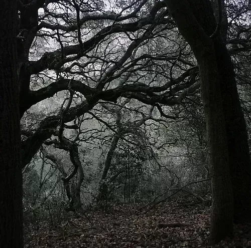
The Terrace to Wildcat Trail starts at the end of Terrace Dr. This in itself requires some explanation. Terrace begins near the base of the hills where Stockton Ave. splits, 2 blocks east of Ashbury. To continue on Stockton you must go left, while the road to the right is the beginning of Terrace Drive. Stockton continues for a little over a half mile before dead ending at Shevlin, though it could be said to continue another block as the Stockton to King Trail (#49). Terrace, on the other hand, head east up the hill, does a great loop south around Huber Park, and then continues north-east until it eventually crosses Moeser Lane. North of Moeser it does a half circle loop east and meets Moeser again, apparently ending there. But if you turn left on to Moeser and proceed east (uphill) one block it is Moeser that ends, at the Arlington, and the street that continues on the other side is Terrace again! East of Arlington, Terrace does an “S” going around and across the PG&E right of way, crosses the ridge of the hills, and then finally ends just after the beginning of Kensington Road.
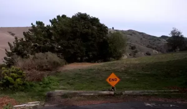
So far, our whole journey has been within El Cerrito, but take one step past the “End” sign and you have left the city and entered Wildcat Canyon Regional Park. Don’t bother looking for a sign telling you that, there isn’t one, you’re just going to have to take our word. The meadow in front of you is in the park, so if the goal was to get directly from El Cerrito to Wildcat Canyon Regional Park, congratulations, mission accomplished! But in reality, you probably would like to get to other parts of the park. Luckily, we now stand at the beginning of a trail that will take us, with some difficulty, to Wildcat Creek Trail, 400 ft. below in the canyon. First of all, ignore the depression just to your left that looks like it might be a trail. It isn’t; it is a gully. Instead, go straight ahead towards the large oak tree, pass under its branches and look to your left down the slope. There you should see a narrow opening in the hedge like undergrowth. Here, at last, is the beginning of the trail proper. And, unfortunately, the end of the easy going.
From here on out the trail will be steep, slippery, and encroached on all sides by vegetation, some of it poison oak. And this first section is the most clearly defined part of the trail. There are places ahead where you will have to look carefully to find the route. This first sections continues in a more or less easterly direction, descending steadily and gradually emerging from the undergrowth until, again under the oaks, it turns north. It continues to drop. even more rapidly. but luckily there are some rough steps cut in the dirt, though very worn, and the trail itself is fairly clear here. This is a mixed blessing. Less than 200 feet from the first turn the trail turns again, southeast, but a false trail seems to continue on the way we have been going and ends in a gully. The real trail goes between to closely set trees, and though discernible from above, doesn’t look as open as the false trail.
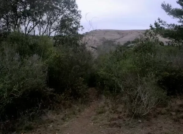
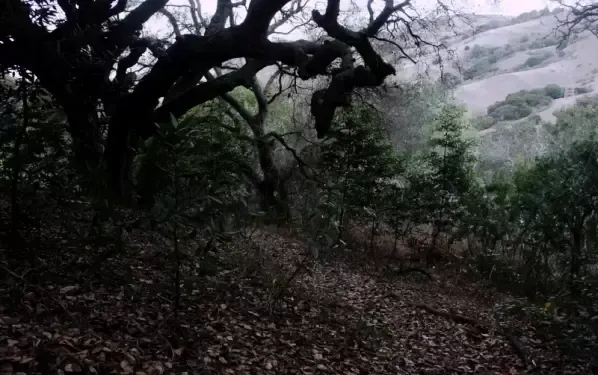
For the rest of the way the path has something of the quality of a deer trail, when it can be seen at all, but in the questionable spots a few steps forward usually makes things clearer. After curving southeast for several hundred feet, the trail becomes straighter. Be careful of a few large steps, once at a large, slippery rock, and again at a small fallen tree. It is in this section that the trail again becomes indistinct. After the fallen tree we soon turn north again, for a short while, before turning again near an impressive line of trees. From here it is just a short drop down to the creek bed.
Wildcat Creek is never very wide or deep, at least here in the hills, but when the water is running you will have to wade to get across. Good thing you are wearing boots. On both banks, the trail ascends smoothly without any major impediments, and on the east side, Wildcat Creek Trail is just up a small rise, beyond a line of vegetation. Once up on Wildcat Creek Trail, a dirt-road-like trail used by walkers, joggers and bicyclists, the boundary between Wildcat Canyon Park and Tilden Regional Park is a little more than 500 feet south. Be warned, this entrance is to the Tilden Nature Area, which does not allow dogs, with or without a leash. There is also major construction going on in the Nature Area, so some trails may be closed or subject to detours.
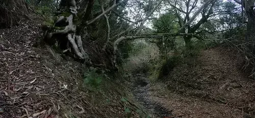
The entrance to the Terrace trail may not be very apparent if you are first trying to find it from the bottom. Those coming north out of Tilden should look for a Madrone tree leaning out over Wildcat Creek Trail about 500 feet past the park boundary. Just after the Madrone are three large eucalyptus trees, and just after them is the opening of the trail. Don’t be fooled by what looks like it might be an overgrown road branching off Wildcat Creek Trail as it curves to the right. The entrance is just before that and at a right angle to the “road”. We hope to do a hike that includes this trail, maybe this summer. It is one of several little known trains from the ridge above. Right now, those wishing to get into Wildcat Canyon would be better served by the trailhead at the end of Rifle Range Road (#21). It is well established, road-like, and cross the creek on a bridge, a good thing give that the rain seems to have finally arrived.
0 Comments